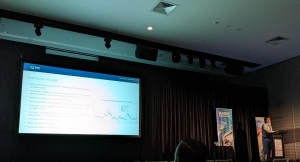
New weather displays at the Victorian Ports Corporation in Melbourne
Victorian Ports Corporation (Melbourne) (VPCM) is the Victorian Government organisation that operates the Vessel Traffic Service (VTS) in Melbourne. In 2019 VPCM commissioned OMC to upgrade their VTS environmental data displays. The upgrade used the PortWeather platform.
Customised dashboards were created for VTS operators, marine pilots, and engineers, enabling optimised viewing of the port’s 60+ metocean instruments. The flexibility of internet browser viewing has enabled easy access to other parties such as exempt ship masters and dredging contractors. Display formats included large VTS screens, mobiles and portable pilot units (PPUs). Alerting and data downloading capabilities were also provided, enabling configurable management of various aspects of the data for different stakeholders.
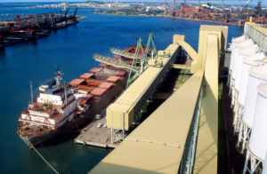
In addition to the display of real-time observations, PortWeather can also display weather forecasts and calculated virtual sources in the middle of channels. When available, it can display raw water levels or winds. This enables OMC to manage as much of the upstream data as possible, which leads to better data availability and quality control. As a vested end user, OMC uses this data for operational products like DUKC® and BerthAlert.
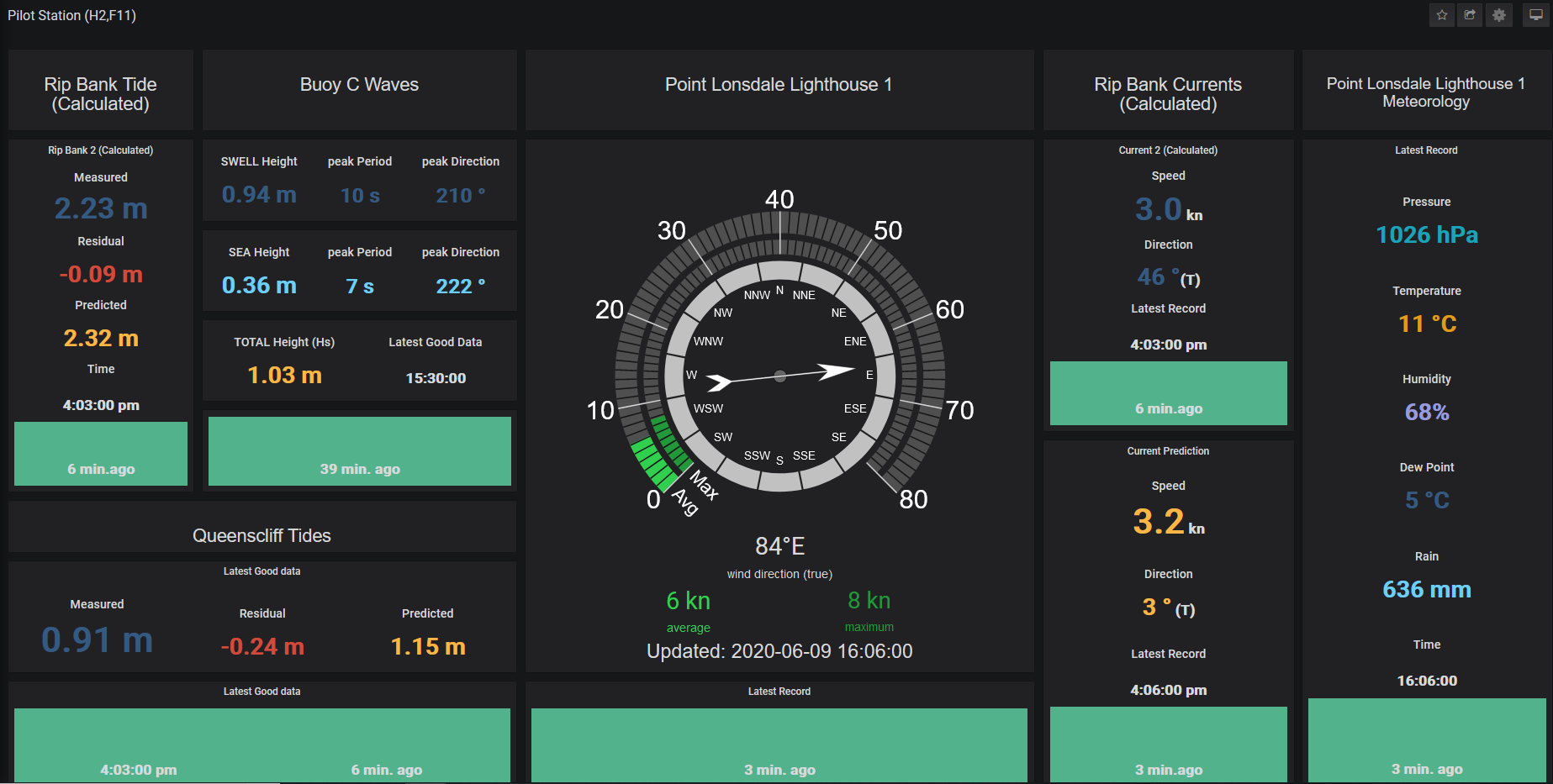
The dashboard below is configured for a permanent pilot station monitor, displaying all the most recent, relevant metocean parameters and their availability.
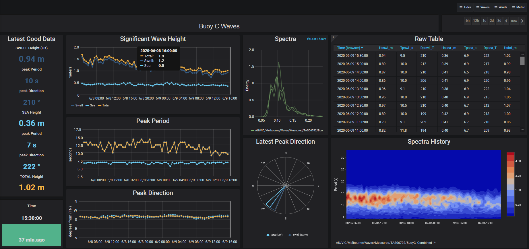
The dashboard below provides engineers with numerous options to view, interrogate and download wave data at selectable timescales.
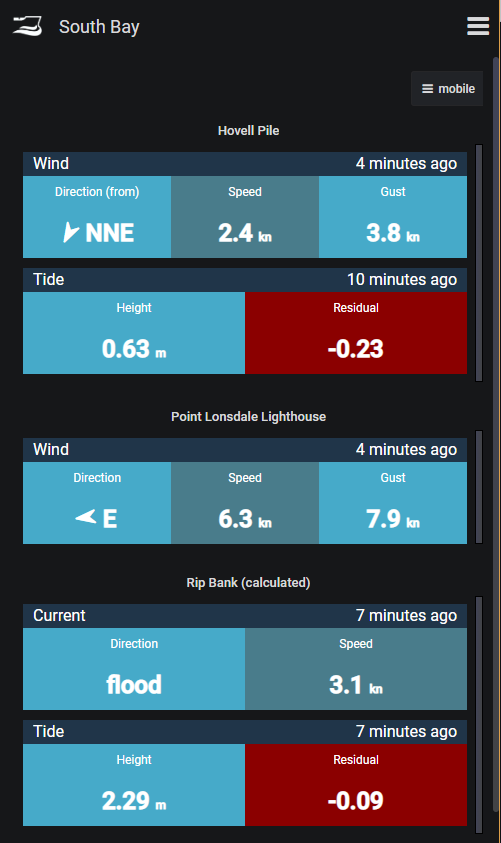
The next dashboard is configured for mobile phones. It includes the display of calculated tides and currents mid-channel at Rip Bank in Port Phillip Heads.
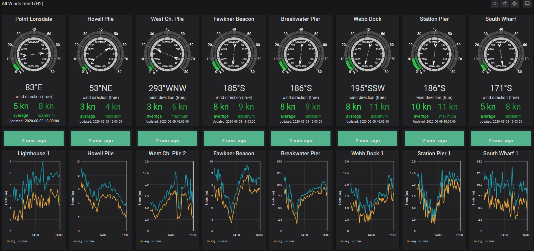
The dashboard below displays wind roses and history plots from gauges along the length of the bay and the channels.
“My involvement with the PortWeather data presentation website began at the first stage – what do we as pilots want to see and how do we want to see it. The end product is a fantastic aid to decision making and planning of passages where wind, weather, tidal height and currents play a role – in Melbourne and Geelong that is every piloted ship! Two aspects are of particular use – knowing we share the exact same data as the VTS and the mobile phone optimised site(s), as this aids in job planning without having our PPU’s open and running. Finally there have been requested changes over time, and these were actioned promptly and to our satisfaction.”
Capt Toby Shelton, Port Phillip Sea Pilots